Friday, August 25, 2017

ccaatt lists of 2017

Earlier this month, DOPA uploaded a new version of their geocode lists, this time changing the format to XLS files. Whereas the rcode file (containing codes for the municipalities) shows no changes compared to the list from last year, there is only one changes in the ccaatt list - it now only contains the Tambon, all the provinces, districts as well as the subdistricts in Bangkok were removed. I have no idea ifr this was intentionally, or a mistake when changing to the XLS format. When comparing it my list of tambon, only two spelling variants show up:
  • Ba Rue Si (บุฤๅษี) wrongly spelled บุฤาษี
  • Su-ngai Kolok (สุไหงโกลก) spelled with hyphen as สุไหงโก-ลก
and I noticed I myself had two misspellings in my spreadsheet, copied from some old erroneous lists and long corrected in the XML version.

Thus the only thing interesting at these new files is what they don't contain - no numbers yet for the two districts in planning in Yala province. As I haven't found anything official about them for quite some time, it seems it still needs quite some time till those get created.

Monday, August 21, 2017

Census 1937 district data

The 1937 census reports include the male and female population numbers for each district (Amphoe), a table covering 30 pages in the publication. I have now completed to convert these numbers into a spreadsheet, as well as my XML format, of all the 408 districts covered by the report. While I have no idea how much these numbers differed from the real numbers back then due to shortcomings in the way the census was conducted, but the numbers in the report all sum up perfectly except two or three obvious number errors - e.g. for Lang Suan the female population was given as 21893 instead of 12893.

As this table includes a column with the ratio between male and female population, there are some interesting strange cases. While for most district the ratio is between 87% and  130%, there are a few district where the male population is very dominant. Bannang Sata in Yala has more than the double number of men than women (4994 vs. 2427), also Samphanthawong in Bangkok (then Phra Nakhon province) has 42200 men compared to 27760 women. The later case is easy to explain - this district covers Chinatown, which at that time had many unmarried male Chinese workers. This can also be seen in the percentage of Thai vs. non-Thai citizen - Phra Nakhon had 29.7% of non-Thai citizen, Yala 13.4%, also Phuket and Ranong had more than 10%. These two provinces also had quite some Chinese workers, at that time the tin mining was still a big part of the local economy.

Though this table only included the full district and counted the minor districts (King Amphoe) together with the district which supervised it, it also made a good cross-check of whether my district data is complete. From all the districts which exist today, and where I had the dates of when they became full districts, only the district Thung Yai in Nakhon Si Thammarat - then named Tha Yang (กิ่งอำเภอท่ายาง) - was missing, because its upgrade to a full district sometime between 1941 and 1948 apparently wasn't published in the Royal Gazette. The only other special cases are three districts in Bangkok which were abolished later - Bang Sue, Bang Phlat, Bukkhalo and Nang Loeng were abolished in 1938, the first two were created again in 1989. While these districts are included in the data, interestingly the districts already uses the names changed in 1938, which among other changes gave the capital districts the Amphoe Mueang names.


Tuesday, August 15, 2017

Tambon of Krabi in 1940

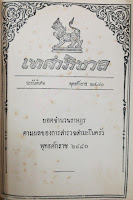
The Local Directory of 1940 (ทำเนียบท้องที่ พุทธศักราช 2483) - one of the books I was able to scan from the Pridi Library - gives the number of administrative villages for every subdistrict, thus it gives me a complete list of all the Tambon in that year. As I suspect that not all the Tambon creations and dissolvements have been recording in the Royal Gazette, and the creation of more than 1000 Tambon in one year always has been very suspicious, this list should be great to consolidate my Tambon data.

Working through all 300 pages will take me several months,  yet as a proof of concept I have processed the Tambon list of Krabi, simply as that province is listed first as being the first in Thai alphabet. And with 534 Tambon today its a relatively small province.

In 1940, Krabi had 39 Tambon and 283 Muban in four districts, compared with 8 district, 53 Tambon and 389 Muban today. All of the Tambon listed in 1940 could be directly matched to a present-day one with the same name, so none was dissolved in the meantime. Only Na Nuea (ตำบลนาเหนือ) in Ao Luek isn't found directly, as it is listed as Pak Lao (ตำบลปากลาว) in the book - but corrected as Na Nuea in the appendix. Actually, the Tambon was renamed in 1940 while the book was compiled [Gazette].

Checking the other way round, there is only one Tambon not present in the 1940 list which has no Royal Gazette announcement on it being created - Sai Thai (ตำบลไสไทย) in Mueang district. It was mentioned in a Gazette announcement in 1952, so it was apparently created sometime in the 1940s. And since the 1937 census included a book with the population for each Tambon (more on that later), there is one more Tambon which changed in these years - Khao Din was renamed from Yan Sao, while it was reassigned from Surat Thani in 1937 it is already included in Krabi.

Krabi was an easy pick as a first step to work through that list, the XML with the data will slowly grow later. Sadly, there were none of the 1000 Tambon in this province, so it doesn't answer yet what was that announcement all about. Also, there were no difficulties like dissolved or renamed Tambon without any official records I could find so far. When I am running into such problems I'll certainly write about them


Monday, August 7, 2017

Census 1929

The 1937 census report was published in five parts, which I was able to look into at the Pridi library last month. I scanned a lot of pages of those books, though only a small subset of the whole books - all those will keep me occupied for quite some time to work through and type into Excel sheets and my XML files. But one first part I could finish already last weekend. One of the parts lists the population development from the previous census in 1929. The 1952 yearbook I found earlier also included that data, but strangely there the numbers did not add up, only the numbers for the south matched.

Now the new scans allowed me to get all the population numbers for each province, with the exception that the provinces abolished in 1932 are not listed separately but are included with those provinces into which they were merged then - for example Lang Suan province (จังหวัดหลังสวน) which was added to Chumphon in 1932. Thus now my data sheet contains all the censuses since 1929, as well as the corresponding XML file. As far as I know no other online resource has this data so far, even the great statoids start at 1947, and has wrong numbers for the early census. It turned out that some more provinces had valid numbers in the 1952 yearbook, but its of course strange how the sometimes quite different values could come up. What is also strange in the tables from the census - the numbers for 1937 are not those in the other parts of the report, e.g. the male/female numbers for each province. It looks as if this part of the report was prepared on preliminary numbers before the final numbers had been compiled. I hope the other parts won't show any other inconsistencies.